top of page
Press Button Below to Submit

Remember to place your phone in the mount!

About the Project
-
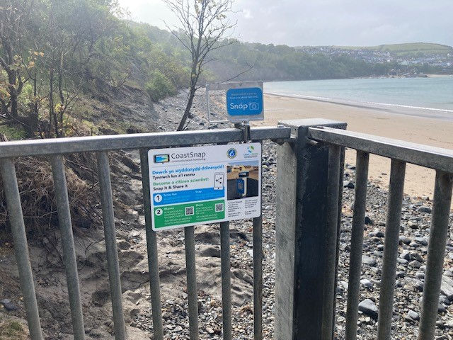
CoastSnap is a global citizen science project which relies on the public taking photos using CoastSnap mounts to ensure the images are from the same perspective every time.
-
Your photos, taken at our installations, will help provide data regarding how coastal processes and climate change are impacting our beaches. Currently we process the images to produce time lapses showing changes across time. Timelapses if available can be found in the site page for each site accessed through the view CoastSnap Photos link above
-
To find out more go to the University of New South Wales CoastSnap project web page here
-
WCMC CoastSnap Privacy Notice
Click the button below to view all our quality controlled CoastSnap datasets and timelapses.
CoastSnap Sites


Map of Welsh CoastSnap Locations updated 05/11/2025
This map displays our CoastSNAP sites. Click on each site to find out the most recent submission numbers and a photo of the site
-
Is your favourite beach or even house, at risk of a 1 in 200 year coastal flood event? Check out the flood layer on the map above to find out!
-
The tidal flood risk model and coastal erosion risk model were developed by Natural Resources Wales, more information can be found here
-
Find out more about the shoreline management plans here
Something wrong? Report issues here
Please use the webform below to inform us of any issues to do with CoastSnap sites in Wales. If an issue requires a response we will endeavour to respond within 2 working days
Images also welcome via:
Email: wcmccoastsnap@gmail.com
Or send us a message via:
Instagram: walescoastalmonitoringcentre
Facebook: Wales Coastal Monitoring Centre
Twitter: @WalesMonitoring
bottom of page